Sheffield Round Walk

The Sheffield Round Walk is a 15-mile loop from the urban to the rural at the southwestern edges of the city – taking in leafy parkland, woodland streams, and pretty suburbs.
The walk connects central Sheffield with its surrounding countryside, showcasing the natural beauty, greenery and wildlife that the city is lucky to have within its boundaries. It starts and ends at Endcliffe Park, a popular spot near the bustling independent cafes, pubs and shops of Ecclesall and Sharrow Vale Roads. From here the route continues alongside rivers – the Porter Brook and the Limb Brook; between trees at Ecclesall, Ladies Spring, Chancet and Brincliffe Edge Woods; past sights like 16th century Shepherd Wheel, Mayfield Alpacas, medieval Beauchief Abbey and Bishops’ House; and across Graves, Meersbrook and Chelsea Parks.
This guide splits the Round Walk into four linear sections, each with its own character – from the picturesque Porter Valley, well trodden by families and dog walkers, to the more urban vantage points of the Gleadless Valley. Each section is round 3-4 miles, so you can tick off sections on different days if you want a more easy-going approach to the route. If you’re completing the walk in one go, be sure to wear sturdy walking shoes.
Look out for the Sheffield Round Walk acorn signs along the route, they'll help to keep you on track.
Distance: approx. 15 miles overall.
Duration: 6-7 hours when done in full.
Terrain: public footpaths, bridleways and roads, can be muddy in parts during winter.
Start: Endcliffe Park, Hunters Bar, off Rustlings Road, S11 7AA.
You can access the guide as a PDF.

1. Porter Valley
Start: Endcliffe Park, Rustlings Road, S11 7AB.
Public transport: bus 81/82/83a/88 to Rustlings Road.
Distance: approx 3.5 miles.
The start of this section, from Endcliffe Park to Forge Dam, is the Round Walk’s most popular stretch. Flat and easygoing, it’s suitable for children and people with limited mobility. It also starts and ends with cafes and playgrounds. Stop off on the way at 16th-century water-powered grinding workshop Shepherd Wheel in Whiteley Woods or Forge Dam Cafe for a cup of tea and a slab of cake. After Forge Dam the route gently ascends to the village of Ringinglow on the edge of the Peak District National Park – home to the Mayfield Alpacas farm and visitor centre and the Norfolk Arms pub.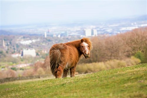
2. Limb Valley
Start: Ringinglow Road, S11 7TS.
Public transport: bus 4 to Ringinglow, Norfolk Arms (infrequent).
Distance: approx 3.3 miles.
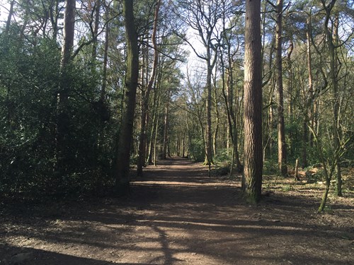
The rural Limb Valley marks the furthest point in the Round Walk from the city centre. From Ringinglow, the route descends alongside the Limb Brook, across quiet open country and through the ornamental grounds of Whirlowbrook Hall – a perfect spot for a picnic. It continues through Whirlow Playing Fields and on to Ecclesall Woods, Sheffield’s largest ancient woodland, where bluebells bloom in spring and, if you explore off the route, you’ll find the Woodland Coffee Stop and Abbeydale Miniature Railway (open occasional Sundays in spring-summer).
3. Sheaf Valley
Start: Abbeydale Road South, S17 3LA.
Public transport: bus 97/98/218 or train to Dore & Totley station.
Distance: approx 3.7 miles.
Perhaps the toughest part of the Round Walk, this section begins with a steep climb in Ladies Spring Wood. The route then takes a country lane in the direction of 12th-century Beauchief Abbey. Only the abbey’s western tower – connected to a more modern church – remains, alongside some ruins. The route continues through Chancet Wood, crosses Meadowhead and heads towards Graves Park. Spend some time in the playground, Rose Garden Cafe and animal farm in the park.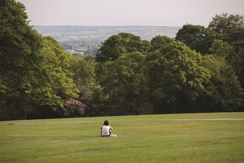
4. Gleadless Valley
Start: Hemsworth Road, S8 8LL.
Public transport: bus 20 to Backmoor Crescent.
Distance: approx 4.3 miles.
This section of the walk begins with heritage woodlands, hidden away behind houses. After Carr Wood, it passes Meersbrook Allotments and continues into Meersbrook Park. Enjoy the panorama of Sheffield and visit the small museum at 16th-century timber-framed Bishops House. The landscape becomes more urban from here on. The Broadfield pub is a good place to stop for a pie, while the shops of the Abbeydale Road and Antiques Quarter are also nearby. Follow footpaths through the pretty residential areas of Nether Edge and Hunter’s Bar, with final stretches of green at Brincliffe Edge Woods and Chelsea Park along the way.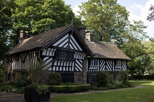
Distance: approx. 15 miles overall.
Duration: 6-7 hours when done in full.
Terrain: public footpaths, bridleways and roads, can be muddy in parts during winter.
Start: Endcliffe Park, Hunters Bar, off Rustlings Road, S11 7AA.
Route map: download as PDF.
All public transport routes mentioned above are from central Sheffield to the start point of each section. Routes may change – for up to date information, check www.travelsouthyorkshire.com.